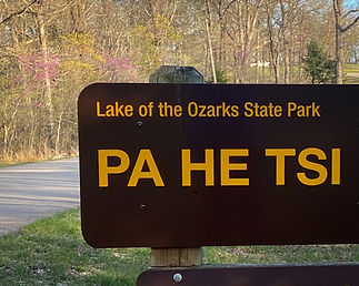
Lake of the Ozarks State Park
On shore, hikers, backpackers, equestrians and bicyclists can wind through open woodlands, sunny glades, small springs and streams to blufftop views of the Lake of the Ozarks. Water enthusiasts can make use of the park’s two swimming beaches, boat rentals and paved boat ramps.
Lake of the Ozarks State Park’s natural beauty and solitude remain untouched, yet visitors are just minutes away from extensive shopping, restaurants and a variety of entertainment opportunities.
*** Attention Professional photographers click here to get the info and application for shooting in Missouri State Parks!
Best Photo Spot - Information
Aquatic Trail
This unique aquatic trail provides boaters with a different perspective of the park when viewed from the Lake of the Ozarks.

Coakley Hollow Trail
This trail meanders through one of the most ecologically diverse areas in Lake of the Ozarks State Park. Six different types of natural communities, including dolomite glades, fens, spring-fed streams and several types of woodlands, can be seen. Rare species such as Riddell's goldenrod, gray petaltail dragonflies and Ozark sculpins are frequently encountered. Other species such as the digger crayfish are found only in the valley in the park.

Hidden Springs Trail
Hidden Springs Trail goes through native Missouri woodlands to bluff tops above the lake. Depending on the season, users may see flowering dogwoods or hear pileated woodpeckers.

Lake Trail
Lake Trail shows a variety of Ozark terrain. Part of the trail is densely shaded and covered in ferns while the rest is open and rocky with areas of exposed chert and few trees and plants.

Ozark Caverns
Caves are common geologic features in areas like the Ozarks, which is underlain by thick layers of soluble carbonate rocks such as limestone and dolomite. Water, seeping through subterranean cracks in these rock formations, begins to enlarge some of the fractures. As the dissolving action of the water continues, the cracks eventually become large, water-filled conduits that form parts of extensive underground drainage systems.

Trail of Four Winds
The longest trail in the park, Trail of Four Winds travels through almost every type of natural community in Lake of the Ozarks State Park. This diversity provides stunning views of the lake, rock outcrops, breathtaking overlooks, seasonal streams, ponds and woodlands.

Woodland Trail
Flowering dogwoods in the spring and warm blazes of color in the fall make Woodland Trail a rewarding hike. This trail goes through the 1,275- acre Patterson Hollow Wild Area.

Bluestem Knoll Trail
Bluestem Knoll Trail gives hikers an idea of how the Ozark landscape looked when settlers first arrived more than two centuries ago. Widely spaced trees, tall native grasses and wildflowers were characteristic of the natural communities found in central Missouri.

Fawn's Ridge Trail
Pleasant views of the dry-mesic chert woodlands found throughout the park can be viewed along the trail. Dominant plants include native white oaks, mockernut hickories, tick trefoils and elm-leaved goldenrods.

Honey Run Trail
Honey Run Trail is actually three diverse trails in one. Starting at the trailhead along McCubbins Drive, this linear portion of the trail immediately goes through a natural community known as the Upland Flatwoods Section.

Lakeview Bend Trail
Lakeview Bend Trail offers an amazing amount of natural community diversity as well as views of the lake. Towering dolomite bluffs and steep rocky slopes that are the result of the erosive forces of the Grand Glaize River can be found along one section. Gentle slopes through native Ozark woodlands characterize the other half of this trail.

Rocky Top Trail
This popular trail is in Missouri's largest state park. It climbs to one of the largest glades in the park. Once you reach the bluff, you will see excellent views of Lakes of the Ozark. This trail is actually two loops joined together for a total of about two miles. Use caution at the edges of the bluff.

White Oak Trail
White Oak Trail is a quiet, shaded trail that follows along a ridge top where various woodland animals such as northern fence lizards, three-toed box turtles or eastern chipmunks may be seen.

SHARE YOUR PHOTOS #bestphotospotlozsp
Other photographers to the site appreciate you sharing your images which builds a stronger photo community!


